This topic provides conceptual information about navigating map content in the XamGeographicMap™ control as well as all supported navigation features of the control.
The following table lists the topics required as a prerequisite to understanding this topic.
This topic contains the following sections:
The XamGeographicMap control inherits navigation functionalities from SeriesViewer control which is also used in the XamDataChart control.
Navigation in the XamGeographicMap control is enabled by default and it allows zooming and panning of the map content. However, this behavior can be changed using the Zoomable property. It is important to know that the XamGeographicMap control allows only synchronized zooming - scaling the map content with preserved aspect ratio. As result, it is not possible to scale the map content vertically without scaling it also horizontally and vice versa.
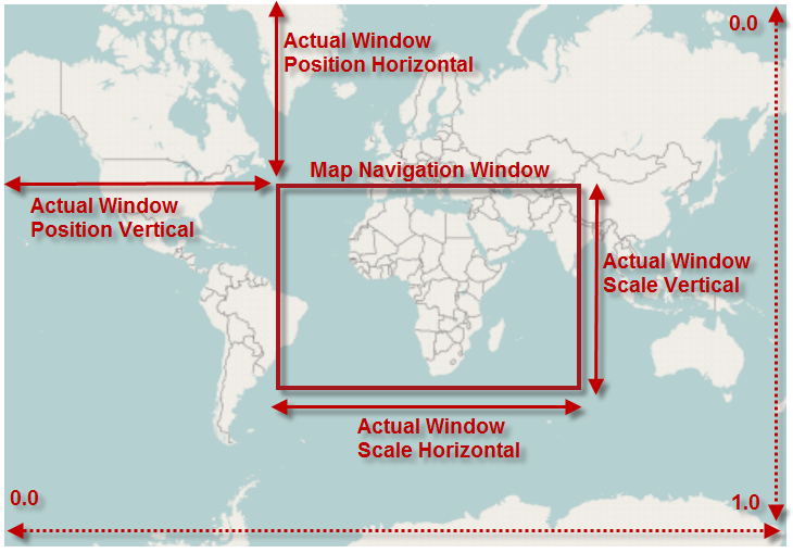
In the XamGeographicMap control, navigation window represents currently viewable area of the map content. The ActualWindowRect property tracks position and size of the navigation window. Each time panning or zooming operation is performed in the XamGeographicMap control, the navigation window changes and the ActualWindowRect property is updated with new values.
The following table summarizes properties used to track navigation window in the XamGeographicMap control:
The following image is a preview of XamGeographicMap control with position and size of the navigation window highlighted when the control was zoomed to some region of the map content (for example, Africa continent).

The following table summarizes navigation features supported in the XamGeographicMap control.
The following topics provide additional information related to this topic.